Hubbard County is a county in the northwestern part of the U.S. state of Minnesota. As of the 2020 United States Census, the population was 21,344. Its county seat is Park Rapids. Part of the Leech Lake Indian Reservation is in the county.
______________________________________________________________________
Hubbard County Coalition Of Lake Associations
Hubbard County Coalition of Lake Associations (HC COLA) is the Leader in Protecting Hubbard County Lakes and Rivers.
Our mission is to protect and enhance the quality of our lakes and rivers, preserve the economic, recreational and natural environmental values of our shorelands and promote the responsible use of our waters and related habitats. Hubbard County COLA’s mission enhances, promotes and protects the interests of lakeshore property owners, lake associations, local government, the general public and future generations.
https://www.hubbardcolamn.org/index.html
______________________________________________________________________
Classified under MN State Statute Chapter 103C, soil and water conservation districts are governmental and political subdivisions of the state. Their broad charge is to protect public health, safety, and welfare through soil and water conservation. Functions include leadership, coordination and services.
A SWCD is a legal body accountable to the public through general elections. Five supervisors are elected to their position, govern the SWCDs and work in cooperation with state and federal conservation agencies. The SWCD is charged with encouraging local landowners to conserve the soil and water resources by implementing conservation practices that reduce or prevent erosion, sedimentation, siltation and agriculturally-related pollution in order to preserve our natural resources, ensure continued soil productivity, control floods, preserve wildlife, protect the tax base and protect public lands.
______________________________________________________________________

______________________________________________________________________
Hubbard County Watersheds
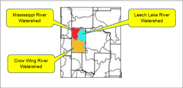
Crow Wing River Watershed
Land use within the watershed is primarily forested/shrub lands, followed by agricultural lands, wetlands, open water, and developed lands. Municipalities located within the Crow Wing River Watershed include Akeley, Menahga, Nevis, Nisswa, Osage, Park Rapids, Pequot Lakes, Ponsford, and Staples. There are a large number of pristine, high-value recreational lakes in the Crow Wing River Watershed and several cold water streams that support trout are located in the watershed.
The Crow Wing River watershed includes over 627 lakes 10 acres in size or greater as well as 1,653 stream and river miles. The Crow Wing River flows into the Mississippi River at Crow Wing State Park. Land use in the Crow Wing River watershed is mostly forested and agriculture.
There are a large number of pristine, high-value recreational lakes in the Crow Wing River Watershed and several cold water streams that support trout are located in the watershed. A handful of lakes and a few tributaries do not meet water quality standards for beneficial uses such as aquatic recreation, drinking, and swimming. The main lake pollutant is phosphorus, causing algae blooms in summer months.
Mississippi River Headwaters Watershed
Approximately 44% of the land in this watershed is privately owned, with the remaining portion of land state, county or federal public land, or held by tribal land owners. Agricultural land use within the watershed is moderate, accounting for approximately 10% of the available acres.
Groundwater springs are present throughout much of the river channel throughout this watershed. These springs are especially common above Lake Bemidji where groundwater contributes approximately two-thirds of the Mississippi River’s flow in this section. This watershed is rich in surface water resources, including some of Minnesota’s most famous lakes and streams. Each year, thousands of anglers travel to this watershed in search of walleye and other game fish.
Currently, the vast majority of the surface water resources within this watershed meet Minnesota’s surface water quality standards for conventional parameter pollutants (not including mercury). However, these resources continue to experience increased pressure from development and subsequent loss of shoreline and aquatic habitat. The threat of aquatic invasive species is also a primary concern for local partner groups, conservation groups, and the citizens within this watershed.
The major threats to the watershed include:
- Loss of shoreline and aquatic habitat due to development. Many of the prime lakeshore properties have been developed with the focus of development turning toward more marginal shoreland and/or shoreland along smaller natural environmental water resources.
- Increased sedimentation due to forest management practices.
- Increased nutrient, contaminant, and sedimentation loading from stormwater runoff from development and other non-point sources.
- Loss of biodiversity due to competition from invasive species.
Mississippi Headwaters Watershed
Leech Lake River Watershed
The Leech Lake River watershed is situated in the heart of Minnesota’s lake country and contains some of the most pristine natural resources in Minnesota. This watershed has a very high degree of biodiversity in its thousands of acres of forests and surface waters. One-half of Minnesota’s naturally producing Muskie lakes and a quarter of the natural Muskie habitat in the U.S. is located in the watershed.
Currently, the surface water resources within this watershed meet Minnesota’s water quality standards for conventional pollutants (not including mercury). However, these resources are experiencing increased pressure from development and subsequent loss of shoreline and aquatic habitat. The surface water resources within this watershed are highly prized for their recreational value and these resources attract several hundred thousand vacationers to the area each year. The protection of these resources is vital in sustaining the local economy and natural heritage and character of this watershed.
The major threats to the watershed include:
- Loss of shoreline and aquatic habitat due to development.
- Population growth of up to 60% projected for the watershed by 2030, according to Minnesota State Demographers.
- Increased nutrient, contaminant, and sedimentation loading from stormwater runoff from development and other non-point sources.
- Loss of biodiversity due to competition from invasive species.
Leech Lake River Watershed
______________________________________________________________________